11 June 2024
Having spoken to the Kununurra Information Centre, discussing with multiple fellow travellers, and much online research, Nicole and I decided that driving into the Bungle Bungles (also known as Purnululu National Park) was a bit out of our comfort zone. All reports were that it was a very rough drive in, and not for the feint hearted. A shame, but there you go.
So, we decided to book a flight over it — and so glad we did. We were treated to a magic day weather-wise, with zero clouds and lovely crisp weather. We also had an early take off of around 6:15am (getting picked up at 5:15am!), meaning we would have lovely light for the flight. Unfortunately, as we were taxiing to take off, I received a tap on the shoulder from behind (I was in the row right behind the pilot).
“Mate, can you get the pilot for me?” was the reqest.
“Is it important, because we’re just about to take off!” was the reply.
“Well, I just tried to turn my overhead light on and saw a puff of smoke.”
The pilot was involved now and said, “How much smoke was there?”
“Oh, a bit I guess.” And on it went.
The pilot had little choice at that point other than to say we would head back to the hangar, hop off the plane, and get maintenance to look at the problem. Not happy Jan.
Anyway, we ended up taking off around 45 minutes later than planned, which wasn’t too bad all things considered.
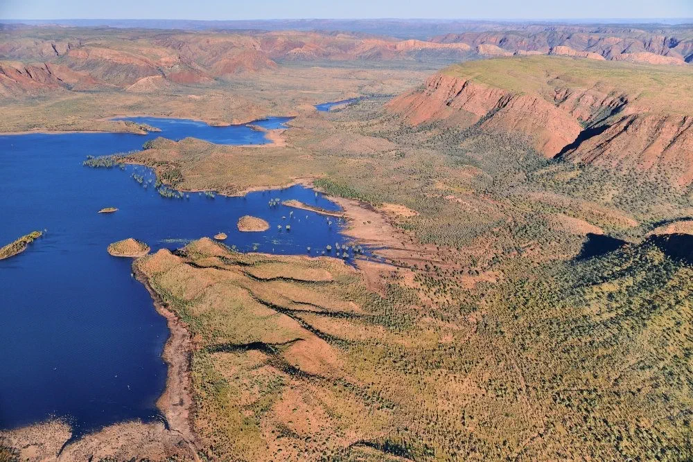
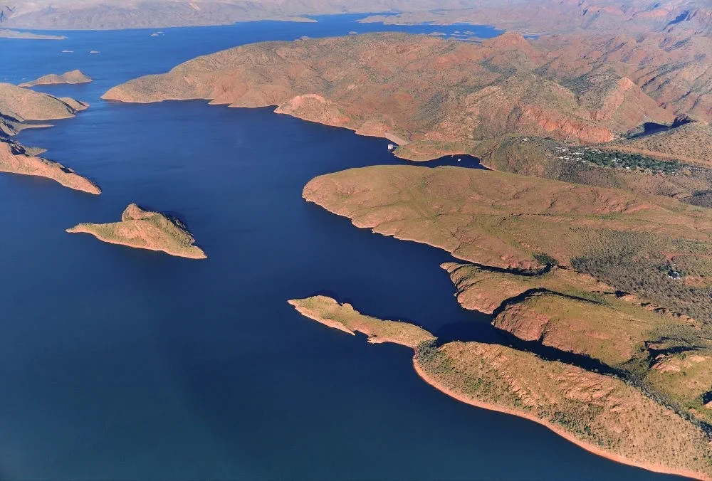
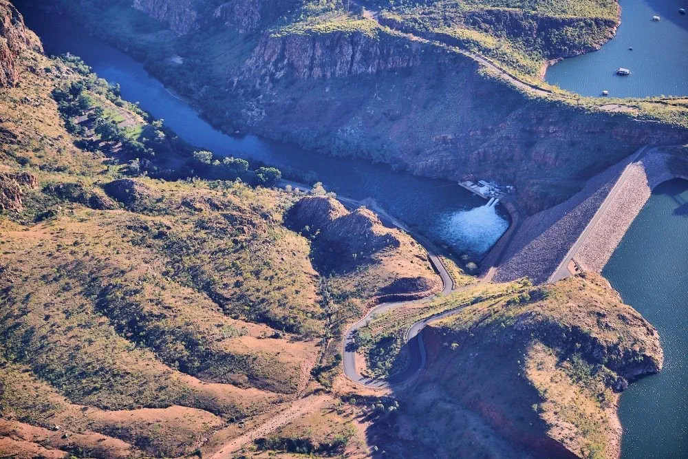
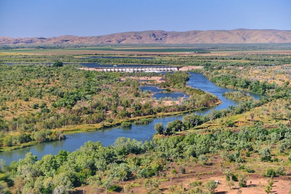
We first flew over Lake Argyle, where we had cruised the day before. Lake Argyle was even more impressive from above. Magnificent!
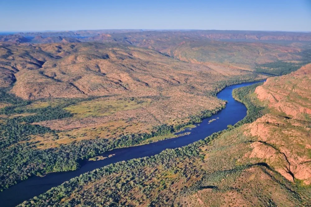
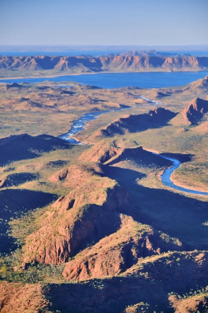
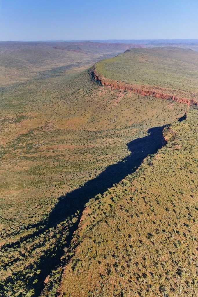
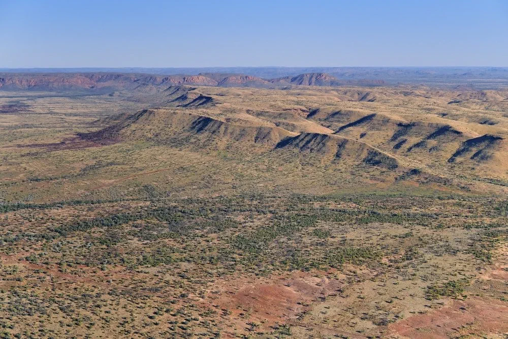
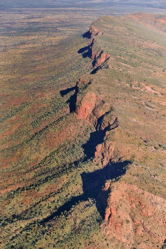
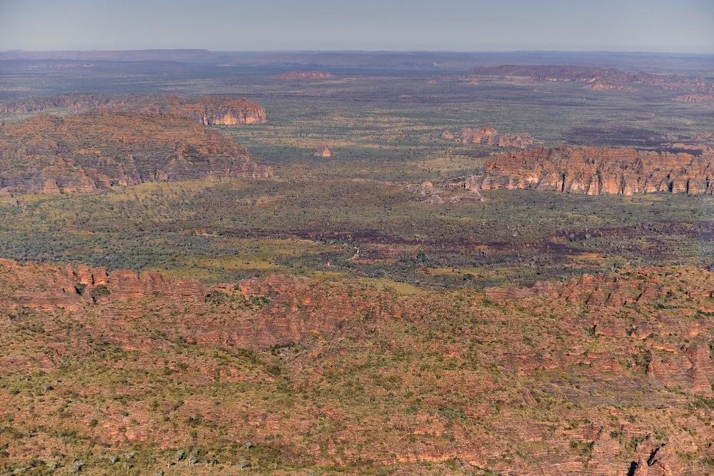
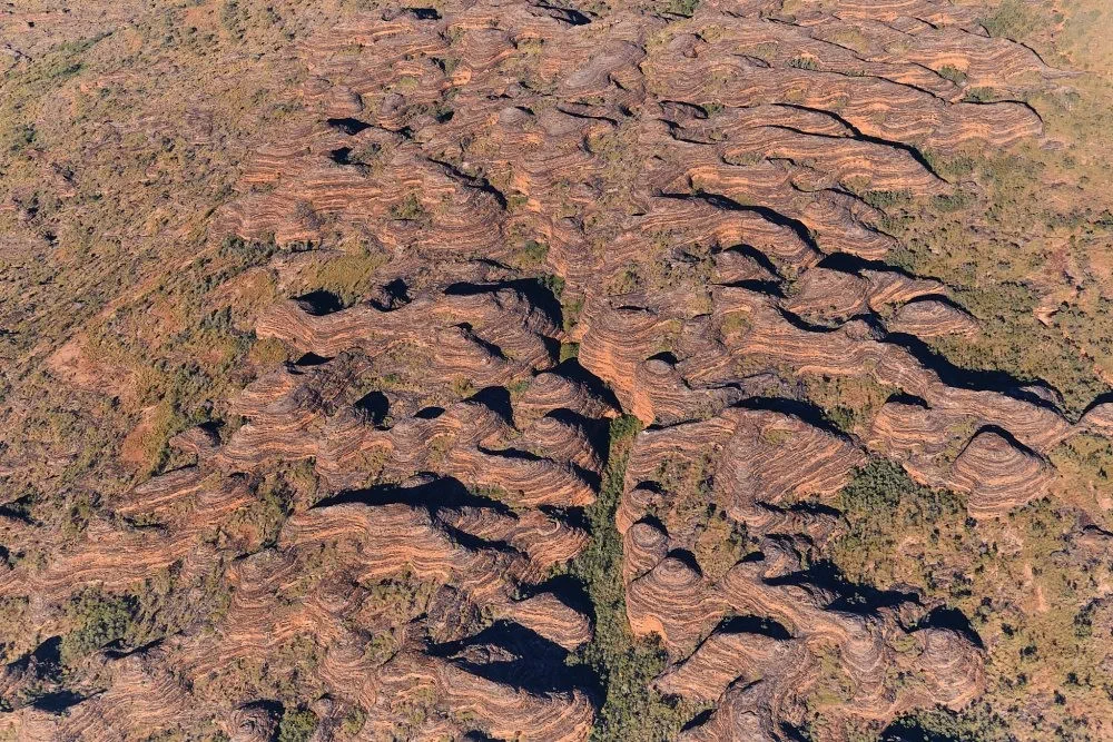
Before getting to the Bungle Bungles we encountered some very interesting land formations.
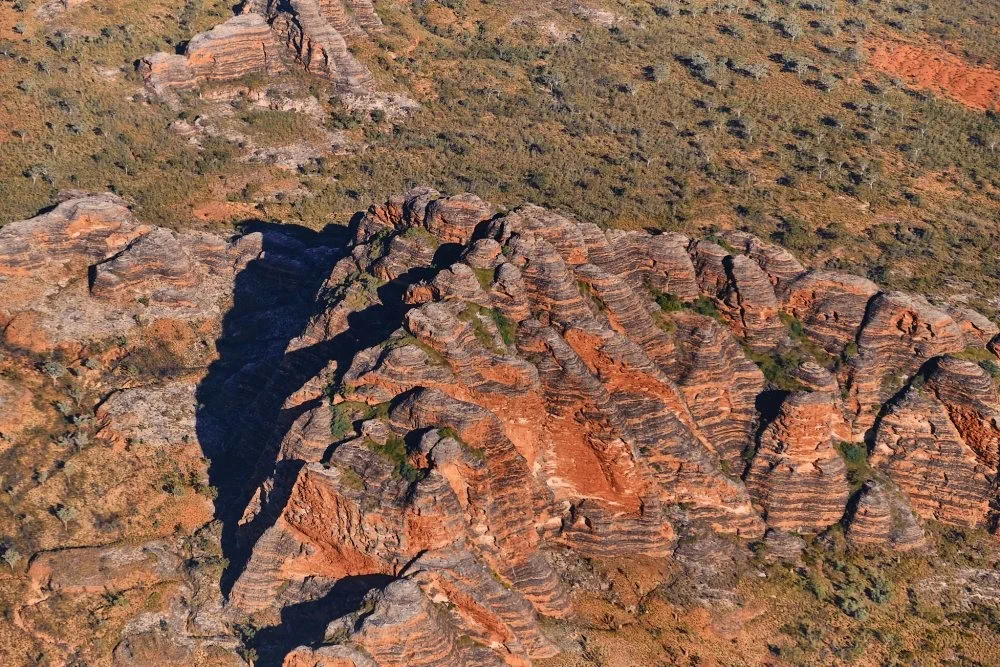
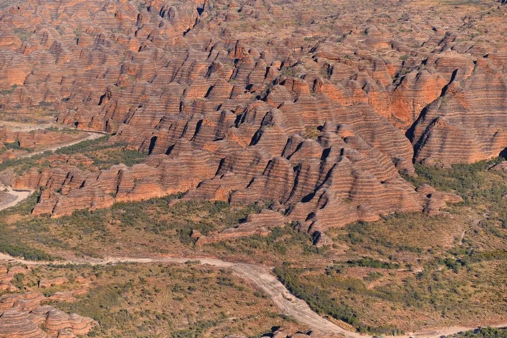
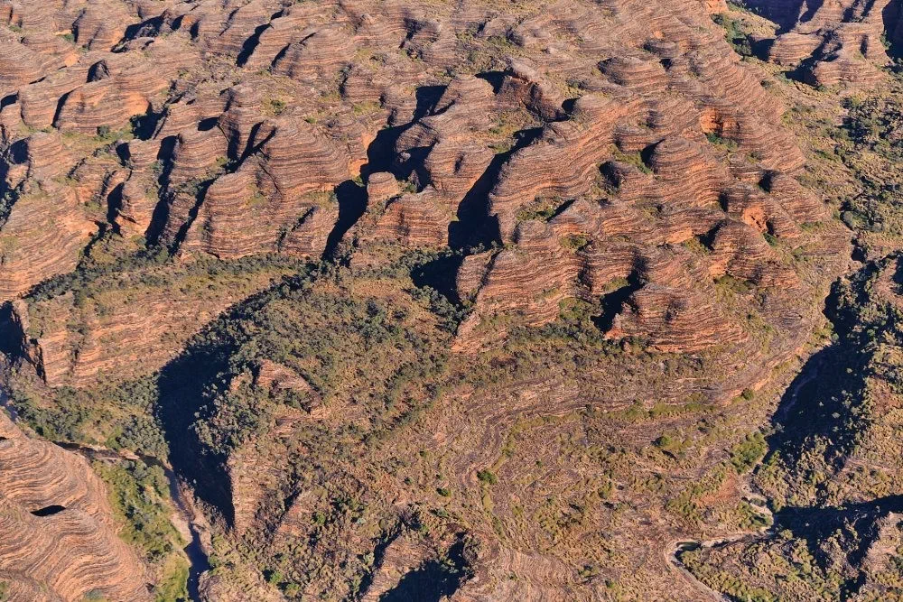
And then it was on to the Bungle Bungles themselves.
The Bungle Bungle Range, lying fully within the park, has elevations as high as 578 metres (1,896 ft) above sea level. It is famous for the sandstone domes, unusual and visually striking with their striping in alternating orange and grey bands. The banding of the domes is due to differences in clay content and porosity of the sandstone layers: the orange bands consist of oxidised iron compounds in layers that dry out too quickly for cyanobacteria to multiply; the grey bands are composed of cyanobacteria growing on the surface of layers of sandstone where moisture accumulates. (Wikipedia)
This is World Heritage Site, and very easy to see why from these photos. Even more magnificent!
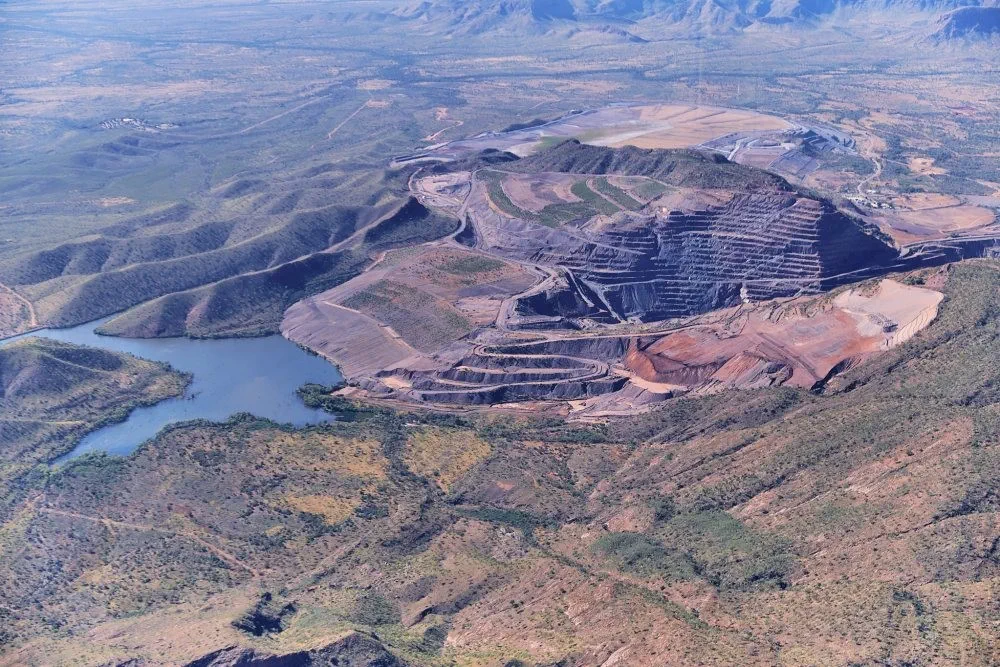
Flying back to Kununurra we flew over the Argyle Diamond Mine, which stopped operating in November 2020 after 37 years of operations and producing more than 865 million carats of rough diamonds. It is now in the process of being decommissioned and rehabilitated.
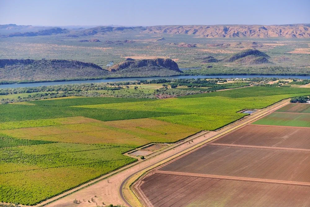
Finally, before landing, we got a great view of some of the agriculture that the Ord River Immigration Scheme supports and Kununurra itself.
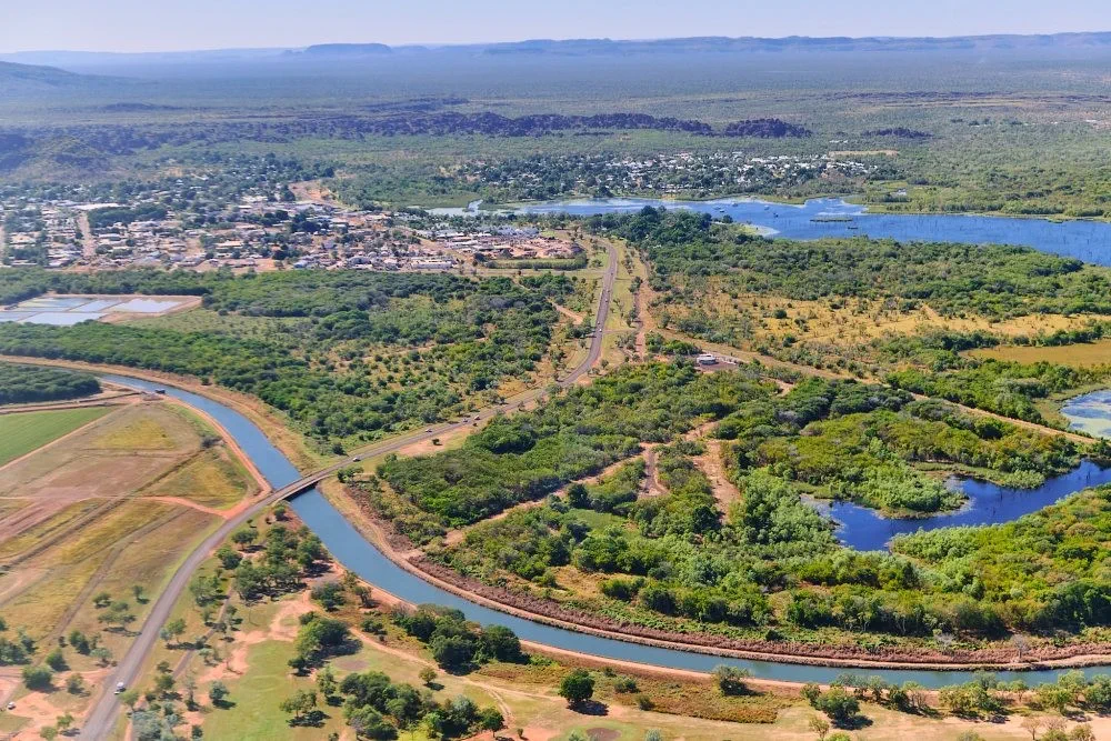
We really enjoyed our stay at Kununurra and will be sad to leave.
← ← Previous · Contents · Next →