15 October 2024
Plan A
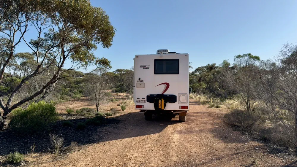
After a restful night in nature, we rose and prepared bacon and egg wraps and coffee for breakfast; our ‘go to’ breakfast when we have a bit of time to get ready.
Our aim today was to reach the 52km Peg Free Camp, named after the distance-marking pegs that start from 0km at the WA-SA border and stretch to the east. We chose this spot as it is literally on the magnificent Bunda Cliffs (also known as the Nullarbor Cliffs) that stretch along a fair section of the Great Australian Bight. So, heading 52km east of the border would mean a drive of 335km, or around 3.5 hours of driving plus stops. That was the plan …
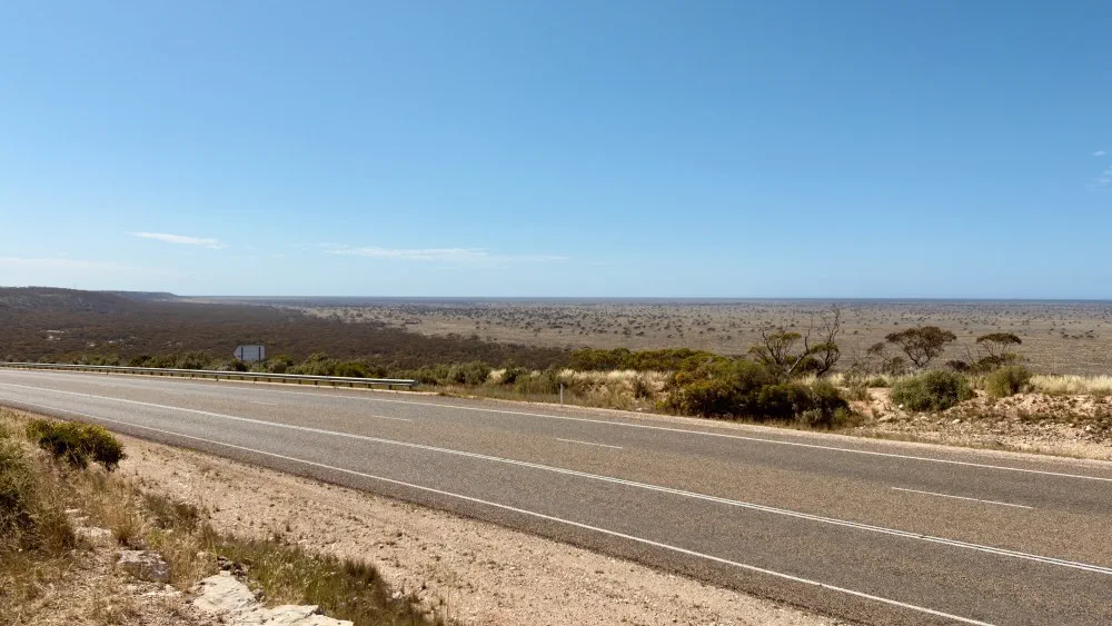
Roughly an hour into our drive we stopped at Madura Pass, overlooking a massive plain and the Madura Roadhouse. Great view!
Plan B
As we pulled up, we saw a couple in an Explorer motorhome that we had briefly said hello to the previous day and started to chat (as you do). Then, next thing, another couple in an Explorer motorhome that we had met at Wave Rock turned up. What are the chances?
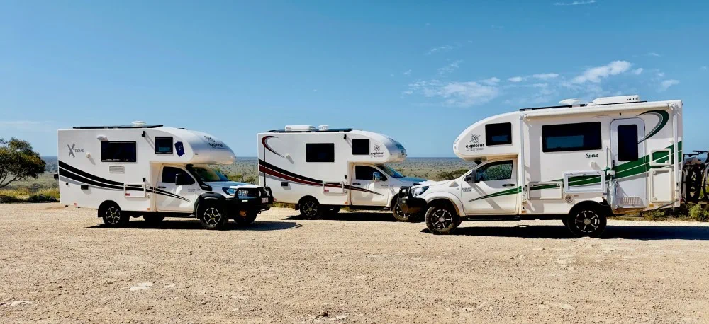
Anyway, it was all very social and one of the couples asked where we were planning to stay that night. They also liked our idea of staying at the 52km Peg Free Camp, and asked if we would mind if they joined us. Our response was that would be great, and then the other couple joined in. So, we departed to make our own separate ways there and meet up for a nice social evening together on the Bunda Cliffs. That was the revised plan …
Uh oh …
We then started heading east, with a plan to stop at the Mundrabilla Roadhouse for a quick rest. Around 45 minutes out from arriving there, Apple Maps (which we use to navigate) brought up a warning that the road ahead across the border was closed. Hmmm, that doesn’t sound good …
It took a little while to get into a mobile reception area, and then Nicole found this online:
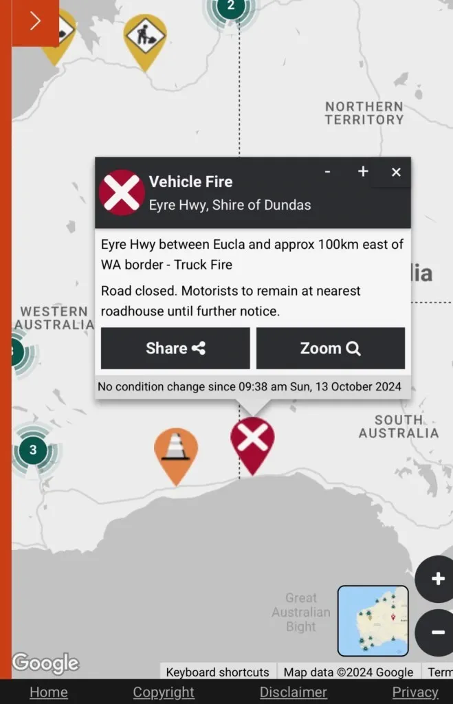
Hmmm, that definitely doesn’t sound good …
When we arrived at the Mundrabilla Roadhouse, we noticed a “Road closed East” sign written on the door. When we chatted to the very nice and helpful lady at the counter, she explained that:
- A semi-trailer with two trailers full of domestic pesticides and chemicals had caught fire, but the driver was safe.
- The fire would take quite a long time to get under control, with the road likely not open until the next day.
- They had been told by authorities to advise all travellers heading east not to go any further, particularly because if the wind swung to coming from the east they would have to move everyone back further to avoid exposure to toxic fumes.
- They had sites free now, but that that would likely change very quickly.
Plan C
We needed to make a decision pretty quickly, and so decided to stay there the night. This would allow us to rest up and re-plan.
One of the other Explorers arrived, and after some discussions they decided to keep heading east (not really what we were meant to be doing). We tried messaging the other Explorer and found they were also heading further east.
So, we then decided to settle in and take it easy. Nicole saw chips and gravy on the board above the counter and weakened, so we enjoyed those having a chat to some of the locals. One was a truckie that needed to get his load of fresh carrots to Sydney, so he was hoping to get going sooner rather than later.
The Bathurst 1000 race was also on that day. I’d resigned myself to missing it, however the unplanned rest day gave me the chance to have a great nap (to recover from the 650km drive the day before) and watch the last 30 laps.
We also started trying to make a revised plan for the next day, so I decided to check how far we were from the border on Apple Maps. This is what it showed me …
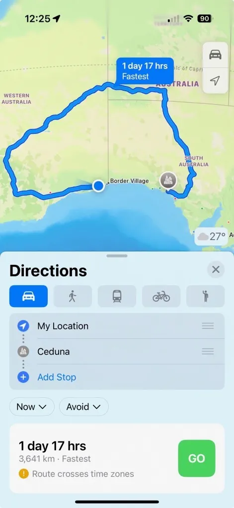
As keen as we were to reach our preferred destination, we weren’t doing that!!
What’s the time?
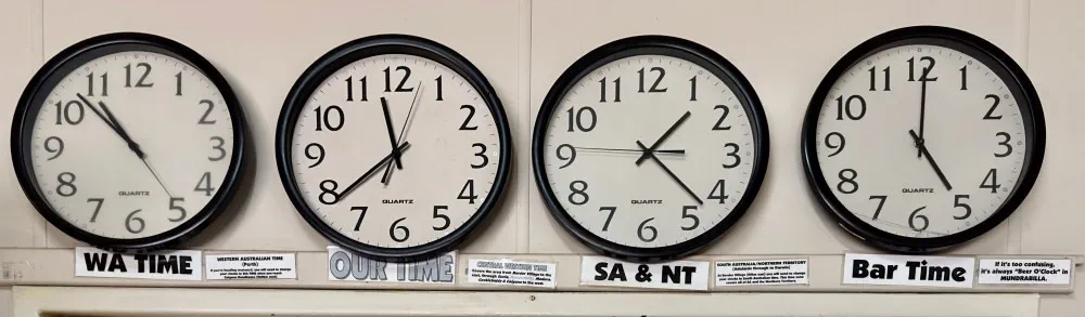
One real challenge we had was knowing what time it was. There is a very peculiar (and I would say unique) set up they have in this area called Central Western Time, affectionately known as ‘Eucla time’, which is WA’s lesser known second time zone. This time zone, covering a small area of the Nullarbor stretching from the eastern side of Caiguna to Border Village on the SA side of the border, is 45 minutes ahead of the rest of WA (even though you are still in WA!) and 45 minutes behind SA time. However, SA had started daylight savings, so that made Mundrabilla 1 hour and 15 minutes behind SA time.
If that wasn’t complicated enough, it is considered an ‘informal’ time zone. Some residents operate on Central Western Time (particularly the roadhouses) and others work on Western Time — the time zone for Perth and the rest of WA. For example, local emergency services operate on Perth time, in order to line up with work schedules set in the state capital.
The mobile phone towers — where your phone gets it’s time from — work on Western (Perth) Time, but when you are out of mobile range (e.g. driving along a lot of the highways or sitting in the Mundrabilla caravan park working off Starlink) our phones decided to go to Central Western Time.
“Fortunately, we have a Telstra tower here, but that works on Perth time, so your phone will be on Perth time unless you convert it to Eucla time manually.” (Central Western Time, affectionately known as ‘Eucla time’, is WA’s lesser-known second time zone)
I’ve come across more confusing things in life, but none come to mind quickly. What a mess!
Anyway, the Mundrabilla Roadhouse has this neat solution (Note the final clock trying to promote bar sales).
But seriously, after seeing the time change on our phones multiple times during the day, we had no idea what time we were eating, going to bed, or waking up. So, we just went ‘old school’ and used the Sun as our guide.
Next day plans
While we’d originally planned to take 4 days to cross the Nullarbor, having made so much progress on Day 1 we’d decided on the morning of Day 2 (before we found out the road would be closed for nearly a day!) to head to Ceduna on Day 3. As such, we’d booked into the Ceduna Foreshore Caravan Park for the third night, as friends had told us you needed to book that one in advance.
Eating dinner, we still weren’t sure what would be happening the next day, however we found out an hour or so before bedtime (note I couldn’t give a proper time there?) that the road was now open, and we would be able to get through the next day. So, with much disappointment, we agreed not to free camp on the Bunda Cliffs this trip and instead drive the 560km through to Ceduna the next day. With most of the points of interest in this section it would be a long day, so we resolved to get up early — whatever the hell time that ended up being!
Let’s hope Day 3 goes to plan …
← ← Previous · Contents · Next →